Background
New Zealand's government announced nearly $2 million in funding to develop a regional satellite-based augmentation system (SBAS) to enhance GPS accuracy across the country. This initiative builds on a 2017 blog discussing centimetre-level GNSS trials.
What is GNSS?
The Global Positioning System (GPS), launched by the USA in the late 1970s, was the first GNSS. Modern alternatives now include Europe's Galileo, Russia's Glonass, and China's BeiDou networks.
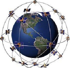
All GNSS systems rely on:
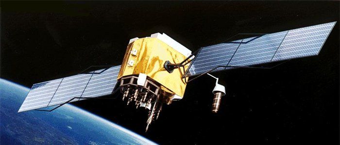
- Satellites orbiting approximately 20,000 km above Earth with precise atomic clocks
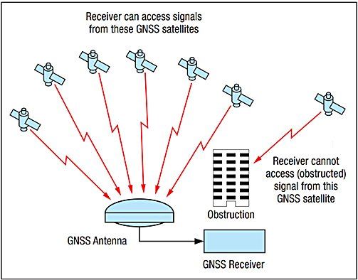
- Ground-based GNSS receivers that calculate position when "seeing" 4+ satellites
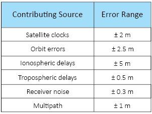
Standard single-receiver accuracy is typically ±10 meters, with errors stemming from satellite clock issues, orbital inaccuracies, atmospheric disturbance, receiver noise, and multipath propagation.
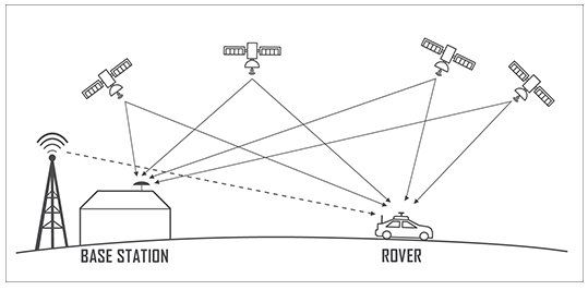
Differential GNSS (DGNSS) technology, implemented in the 1990s, improved accuracy to 1-2 meters, while newer Real-Time Kinematic (RTK) methods achieve 1-2 centimeter precision.
SBAS Technology
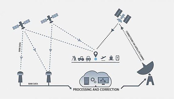
Rather than relying on single reference stations, SBAS deploys multiple stations across operational areas, generating atmospheric effect maps for broad coverage. This system corrects satellite orbital and clock errors, broadcasting correction data via geostationary satellites on existing GPS L1 channels, requiring only firmware updates for compatible receivers.
Current systems in the USA (WAAS) and Europe achieve 1-2 meter positional accuracy.
Why No SBAS Yet?
Both time and funding constraints have delayed implementation. Land Information New Zealand (LINZ) collaborated with Geoscience Australia in a two-year trial beginning 2016, testing three technologies:
- Single frequency SBAS (±1m accuracy)
- Dual frequency/Multiple Constellation SBAS (sub-±1m accuracy)
- Precise Point Positioning (±10cm accuracy)
Trials concluded successfully in January 2019.
LINZ allocated NZ$1.992 million in 2019 funding, while Positioning Australia received A$160.9 million in their 2018-19 budget for joint regional SBAS development.
Applications
SBAS enables:
- Precision navigation for aircraft, autonomous vehicles, and drones
- Improved helicopter rescue operations in challenging terrain
- Virtual fencing for livestock management
- Enhanced workplace safety in forestry operations


Timeline
Investigations and procurement occur through 2020, with tenders expected in 2021. The technology is projected to become operational by 2023.